Collaboration Without Compromise

A Billion Polygons Points Pixels in Your Pocket

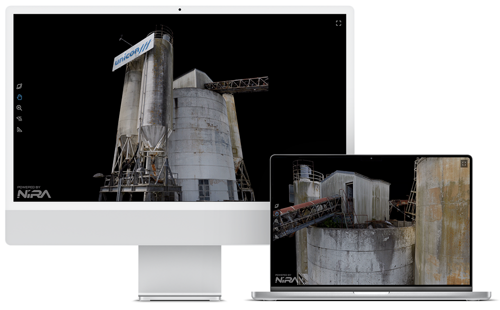
Nira is a collaborative platform for rendering massive 3D models in real time, enabling interactive, web-based visualization and inspection on any device, including smartphones and tablets.

A New Approach

Flexible Pipeline from Start to Finish

Leverage the full potential of your 3D data by swiftly transforming it into valuable insights. Combine data from multiple sources and craft the ultimate curated experience.

Support for all Photogrammetry, Point Cloud, Gaussian Splat, AEC, and DCC Applications

RealityCapture®
Agisoft Metashape®
DJI Terra™
DJI® Modify™
3DF Zephyr
iTwin®
OpenDroneMap™
Skyline® PhotoMesh™
Pix4Dmapper®
Pix4D®matic
SimActive®
Autel® Mapper™
Jawset Postshot
Nerfstudio
Matterport®
Autodesk® ReCap™ Pro
RIEGL®
Leica®
Z+F® (Zoller + Fröhlich)
FARO®
NavVis
Trimble® Business Center
LiDAR360
YellowScan® CloudStation®
Inertial Labs
Emesent®
XGRIDS
Exyn
VIAMETRIS®
Artec 3D®
LidarMill
Shining 3D® EXStar®
Autodesk® Revit®
Autodesk® AutoCAD®
Autodesk® Navisworks®
Trimble® SketchUp®
Blender
Autodesk® Maya®
Autodesk® 3ds Max®
ZBrush®

Store

Inspect

Visualize

Measure

Compare

Markup

Annotate

Configure

Any modern tablet running iPadOS, Android, or Windows

Tablet

Any iOS & Android Browser
Any modern smartphone running iOS or Android

Mobile

Any iOS & Android Browser
Easily generate detailed reports and export them as PDF files for streamlined sharing and review

PDF Reports

Seamless PDF Export

Nira in Action

Nira Demos

View a selection of curated Nira sample assets

Georeferenced Inspection & Surveying
Photogrammetry for Entertainment & Historical Preservation
Volumetric Video
Use Case

A Wide Variety of Domains

Nira supports any asset type, from any domain, so you and your clients can more intelligently make decisions in real-time.

NIRA Community

See What’s Possible

Discover how professionals are innovating with their success stories

Explore Nira

Sign Up for a Free Trial to Get Started

Enjoy a 15-day free trial of Nira, then choose a plan that suits you.

Unsure which option suits you best? Reach out to our team—we’re here to help!

Applications

3DF Zephyr
AliceVision Meshroom
Artec 3D
Autel Mapper
Autodesk AutoCAD
Autodesk Maya
Autodesk Navisworks
Autodesk ReCap Pro
Autodesk Revit
Blender
CloudCompare
DJI Terra
DJI Modify
Emesent
Exyn
FARO
GeoSLAM
Inertial Labs
iTwin
Leica
LiDAR360
LidarMill
Matterport
Metashape
NavVis
OpenDroneMap
Pix4Dmatic
Pix4Dmapper
RealityCapture
RIEGL
Shining 3D EXStar
SimActive
Skyline PhotoMesh
Trimble Business Center
VIAMETRIS
XGRIDS
YellowScan CloudStation
Z+F (Zoller + Fröhlich)
ZBrush

File Types

Textured Meshes

.obj
.fbx

Laser Scan Data

.e57
.las
.laz

Gaussian Splats

.ply
.splat
.spz

Orthomosaic Maps

.tiff

Photos

.jpg

Textures

.jpg
.png
.exr

BIM

.ifc

Linework

.dxf

All trademarks and copyrights belong to their respective owners.